
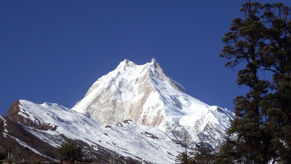
Although trekking in the Manaslu and Larkey pass region was started in 1995, the Tsum Valley Trekking was opened for foreigners only In 2008. Thus the Tsum Valley is the newly discovered trekking route in entire Nepal. The Tsum Valley Trekking route was stimulated by local people with the support from Nepal Government. Not far from the Manaslu chain, at the foot of the snowy peaks of Ganesh Himal, the Tsum Valley sections from 1,800 meters to the wild peaks that mark the border with Tibet. At least one hundred and fifty kilometers from capital Kathmandu, this territory long forgotten today is a haven for Tibetan Buddhist culture. Similarly, the Tsum valley is also the gateway to the Ganesh Himal base camp, with wonderful views of Ganesh Himal and surrounding landscapes.
The trek to Tsum valley is incredibly less trodden Path. The Tsum region is naturally striking with rich culture and high mystical values. The traditional way of life is unique; a forgotten area that still keeps a people of precise traditions and some details of which have no comparable or north or south. An example would be the practice of multiple husband system or polyandry. Brothers from a family can marry a single woman. The Tsum Valley Trekking takes you to Tsum which is a world apart, where traditional villages alongside dazzling Buddhist gompa, where friendly people open the doors of their homes to visitors, and where modernity makes a timid appearance.
Tsum is the holiest Buddhist pilgrimage site in Gorkha. There are several Gompas you can explore in Tsum Valley Trekking, such as RachenGompa, Mu Gompa, Galdag Gompa, Milarepa cave, Nunneries Gompa and many more. Miles of mani walls, stone-carved and elaborate chortens dot the surrounding trails. The caravans of yaks and horses continue to be perpetuated heavy traffic between the lower valleys of Nepal and the Tibetan highlands. Most of the monasteries perpetuate the traditions of study and prayer of Tibetan Vajrayana Buddhism.
Tsum Valley Trekking is categorized as moderate level trekking and can be completed buy all the avid trekkers throughout the world. Previous trekking experience in the high altitude will help you to complete the trek more easily. Tsum Valley Trekking route is recently opened for foreigners so there are not so many guest houses and lodges but the locals shows huge love and respect with great hospitality in Home-stay. Home-stay in Tsum Valley Trekking is a best chance to learn closely about the unique traditions, culture and lifestyle of the rural Himalayan peoples.
| Day | Program | Elevation |
|---|---|---|
| 1 | Arrival and Transfer to Hotel in Kathmandu | 1340m |
| 2 | Kathmandu – Arughat – Soti Khola , 8-9 hrs drive | 670m-710m |
| 3 | Soti Khola – Machha Khola , 6-7 hrs | 890m |
| 4 | Machha Khola – Dobhan , 6-7 hrs | 1000m |
| 5 | Dobhan – Philim , 6-7 hrs | 1590m |
| 6 | Philim – Chumling , 6-7 hrs | 2360m |
| 7 | Chumling – Chhekampar , 5-6 hrs | 3010m |
| 8 | Chhekampar – Nile , 4-5 hrs | 3480m |
| 9 | Exploration day: Nile – Mu Gompa – Chhekampar , 6-7 hrs | 3709m-3010m |
| 10 | Chhekampar – Gumba Lungdang , 5-6 hrs | 3200m |
| 11 | Exploration day: Gumba Lungdang – Ganesh Himal BC – return, 7-8 hrs | 4200m |
| 12 | Gumba Lungdang – Ripchet – Lokpa , 7-8 hrs | 2470m-2240m |
| 13 | Lokpa – Sirdibas , 5-6 hrs | 1430m |
| 14 | Sirdibas – Khorlabesi , 5-6 hrs | 970m |
| 15 | Khorlabesi – Soti Khola , 5-6 hrs | 710m |
| 16 | Soti Khola – Arughat – Kathmandu , 8-9hrs | 1300m |
| 17 | Final departure |
No reviews yet. Traveled with us on this trip? Be the first to share your experience.
Enjoy the popular trekking and tour packages in Nepal Himalayas. 2026.
Manaslu & Tsum Valley Trekking is very famous trekking in Nepal. Tsum valley is in restricted area of Nepal and trekking to Tsum Valley is opened
View Details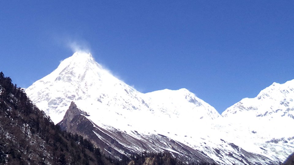
Manaslu trek of 18 days trekking is popular trekking route in Manaslu region of Nepal offers challenging, rich cultural experience.
View Details
Manaslu Circuit trek is one of the popular trekking package with excellent mountain views. Trekking to Manaslu in teahouse/camping
View Details
Budget Manaslu Circuit Trek is low budget trekking package in Manaslu region. Manaslu Circuit trekking in low budget cost. Contact us now
View Details